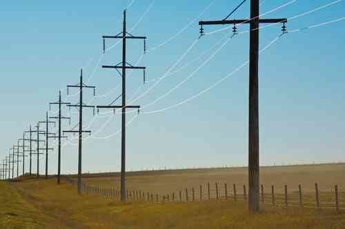
What Is LiDAR & Why Is It Important to Power Providers?

Posted by Ashley Little on June 2, 2020

LIDAR-Technology-Drone

Utility companies have always needed data that supplies an up-to-date picture of their infrastructure. Traditionally, that was gathered by experienced field technicians making visual observations, taking photographs, and measuring assets using devices such as extendable fiberglass poles (hot sticks).

What has changed? Joint use of utility poles is intensifying rapidly, and significant changes to infrastructure are happening more frequently. Communications companies are attaching more equipment to utility poles than ever before – many with permission, some without. Accurate data is key when issuing joint use permits. Meanwhile, keeping asset data current is a demanding job.

These days, more utility companies are looking into and/or deploying a technology that has been around for several decades but, for much of that time, was used mostly by the military, law enforcement and some large engineering firms: LiDAR.

How Does LiDAR Work?

LiDAR (Light Detection and Ranging) uses pulses of light – many thousands per second – to measure distances. The pulses are invisible to the human eye, and each pinpoint measurement is recorded by a sensor. The technology is expensive but extremely accurate and useful, and the price has been falling in recent years as more companies and institutions have employed it. The move toward self-driving automobiles is a big factor in reducing costs.

LiDAR data is intricately detailed and can be used to create a digital copy of whatever it measures – in industry terminology, a “digital twin,” explained by Forbes as a bridge between the physical and digital worlds. For power providers, the thousands of individual measurements can be combined to create a point-cloud reproduction of  utility poles, lines, attachments, and anything else that is measured, such as vegetation encroaching on power lines. It brings into the office a true representation of what a technician sees in the field.

For large utilities, LiDAR offers faster and more efficient data collection without sacrificing accuracy. Its measurements are comprehensive, and a single LiDAR survey of a company’s infrastructure can be used for a variety of purposes.


Forms of LiDAR Data Collection

The way LiDAR data is collected depends on a company’s needs and goals. Common forms are:

  • Handheld
    A field technician can use a device not much bigger than a cellphone, called a
    hypsometer. If the terrain is not too challenging,  this method can be used to collect data on more than 75 poles per day.

  • Vehicle-mounted
    This form of collection works well when poles are within 150 feet of the road.

  • Drone-mounted
    This method of gathering data is becoming widely used often in combination with boots on the ground.

  • Fixed-wing aircraft or helicopters carrying LiDAR
    It adds cost, but if you have thousands of miles of assets to survey, this could be the solution.

LiDAR isn’t an either/or proposition. The different forms are useful in combination with one another as well as in combination with other forms of data collection. A technician may use a hypsometer for quick, accurate measurements, use a digital camera to photograph poles and guy wires, and check the pole stamp to get supplemental data such as “born on” dates and pole classifications.


How is LiDAR Used?

Some of the major applications for utilities are:

  • Asset capture and management. One reason utilities use LiDAR is to gain an accurate picture of their assets and other companies’ attachments. The data gathered can guide decision-making and can be fed into software to perform a structural load analysis on the poles.

  • Vegetation management. LiDAR is also used to capture vegetation data. Additional LiDAR measurements can be used to calculate growth patterns and help the company guide its tree-trimming decisions.

  • Thermal imaging. LiDAR can detect equipment that is running hotter than it should, which may indicate a lightning strike or impending failure of the equipment. This allows a company, through analysis, to take a proactive approach to repairing or replacing equipment instead of reactive.

LiDAR’s uses are multiplying outside the utility field as well. As outlined by Geospatial World, the technology can measure the distance between cars to ensure the safety of self-driving automobiles; determine the sun exposure of land for farming; create pollution models for a community based on particle content of the air; map the beds of rivers and creeks to help with flood planning, and identify potential sites for archaeological digs. Some cities are using LiDAR for purposes such as measuring sidewalks and ramps to determine whether they comply with the Americans with Disabilities Act.

A report from Grand View Research projects the global LiDAR market size will reach $2.9 billion by 2025, with airborne LiDAR increasingly dominant, according to Cision PR Newswire.


Creating a System of Record

The prospects for using LiDAR in the utility industry are exciting, but they also place premium value on data management. You have to be able to act quickly on the data you have. All the useful information gathered through both high-tech and conventional methods can be stored and organized into a Standard System of Record (SSoR) like the Alden One® platform. A utility can use this system to view trends to make important decisions and track the growing number of interactions with other companies in the joint use community.

To accomplish that task in the current hyper-charged environment, you need a partner that is truly up to the job. Alden One® is the nationally recognized leader in centralized asset management platforms for joint use. It simplifies data organization and sharing among multiple departments. Alden’s consultants have expertise in LiDAR, other emerging technologies, and traditional forms of data collection, and we can help find the combination that’s just right for your company’s needs.

If you’d like to learn more about what Alden offers, contact a product specialist here.

Placeholder (Update When CTA Is Approved)


Comments